
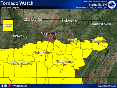

The National Weather Service issued a tornado watch for Williamson County Tuesday afternoon, which will be in effect until 10 p.m.
Beyond the threat of tornadoes, a Hazardous Weather Outlook has also been issued for the county, which brings with it the chance of severe thunderstorms, damaging winds and large hail.
“For Williamson County, the best threat is probably at the 4-7 p.m. time frame,” said NWS Meteorologist Faith Borden. “The main threats are strong straight line winds and hail, and then an isolated tornado threat - they could be large, possibly violent tornadoes.”
The NWS also reports that locations south of I40 — Williamson County is just south of of the interstate — residents could expect one to two inches of rain, with some areas experiencing up to three inches.
Temperatures will drop Tuesday night into the high 40s, with rain persisting potentially until 2 a.m. Wednesday morning.
A tornado watch simply means that weather conditions are favorable for producing tornadoes, whereas a tornado warning means a tornado has been sighted or detected by radar.
Commented
Sorry, there are no recent results for popular commented articles.